We offer a more accessible version of this page content in the light version.
Visible through a clearing, the Rivière La Martre winds its way through tall grasses surrounded by tall conifer trees under an overcast sky.
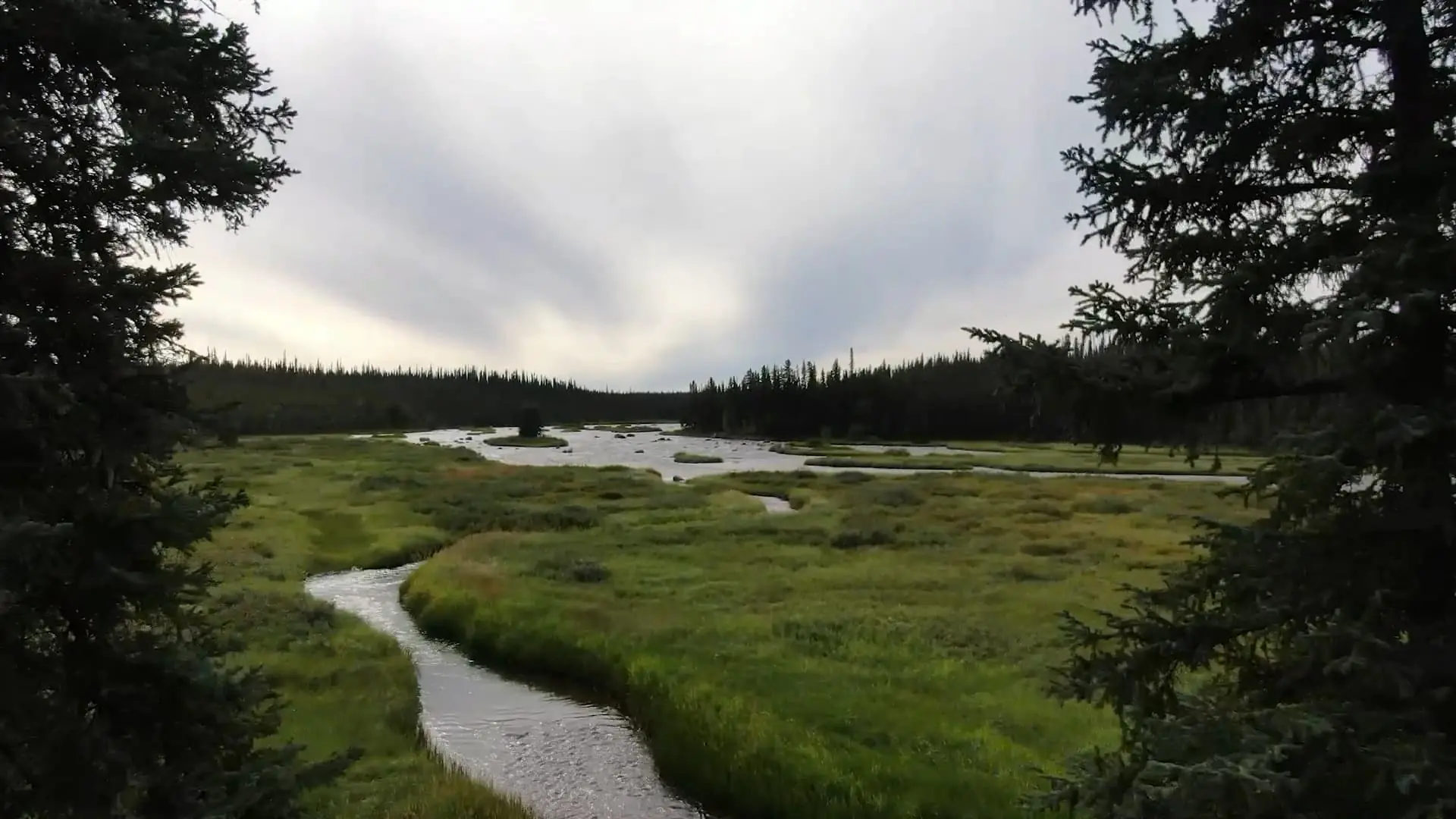
Drone fly-over footage from above the Rivière La Martre as it passes through the forests and open fields in the wild landscape between the Tlicho communities of Behchokǫ̀ and Whatì found in Canada’s Northwest Territories. The montage of clips contain overhead shots of river rapids, dense forests, abandoned cabins, lakes, and a waterfall.

Gowhaèhdǫǫ̀ Gıɂetǫ k’è weghàı̨da

See The Trails Of Our Ancestors

Scroll Down

Regional map showing the cities and towns of Alaska, British Columbia, the Yukon and the Northwest Territories.Regional map showing the cities and towns of Alaska, British Columbia, the Yukon and the Northwest Territories.

We are Tłı̨chǫ people living in the Northwest Territories, Canada.

Our land is beautiful, our stories are powerful.

A regional map of the Tłı̨chǫ boundaries and communities. The two communities are located above Great Slave Lake, northwest of Yellowknife.A regional map of the Tłı̨chǫ boundaries and communities. The two communities are located above Great Slave Lake, northwest of Yellowknife.

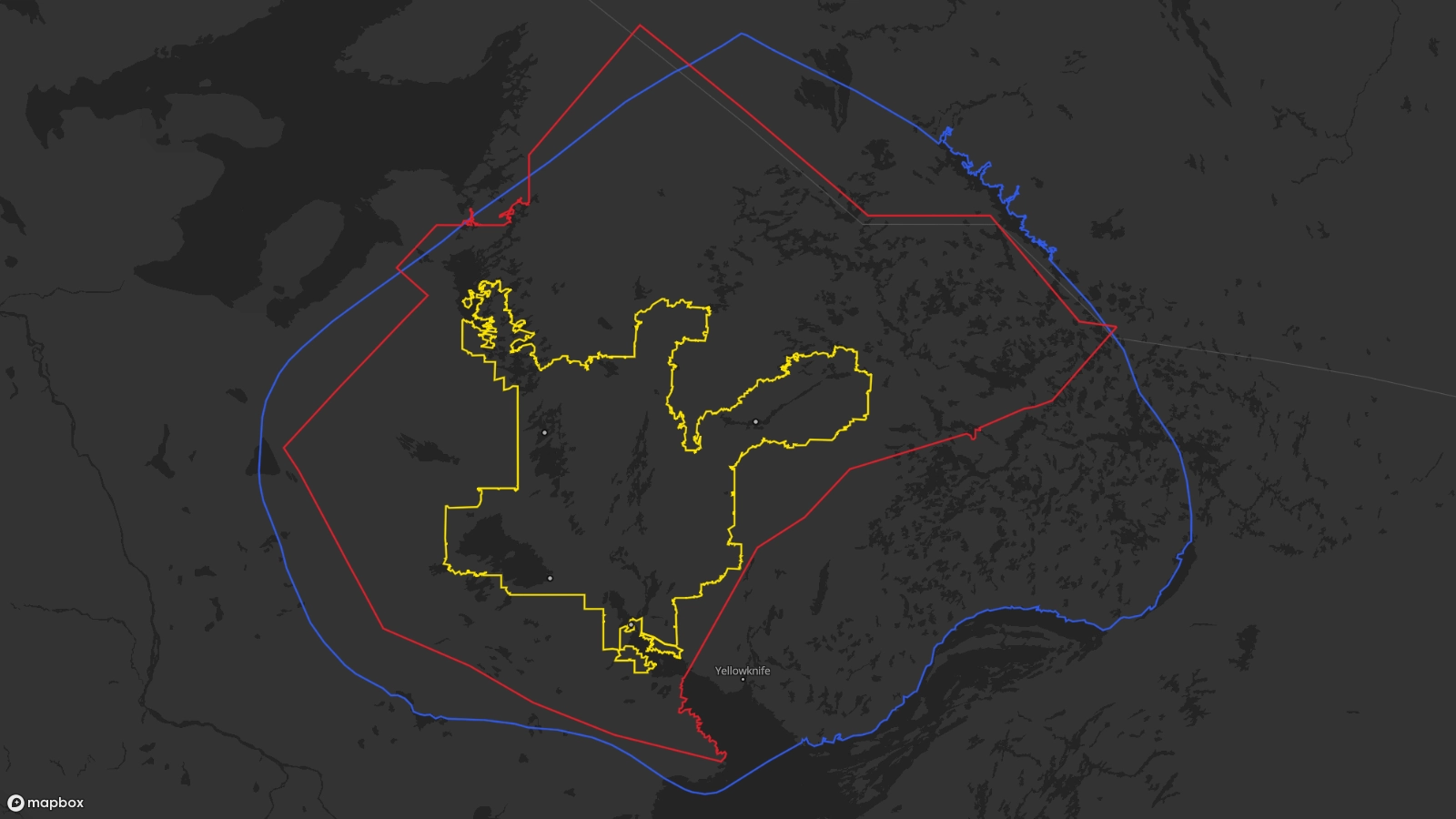
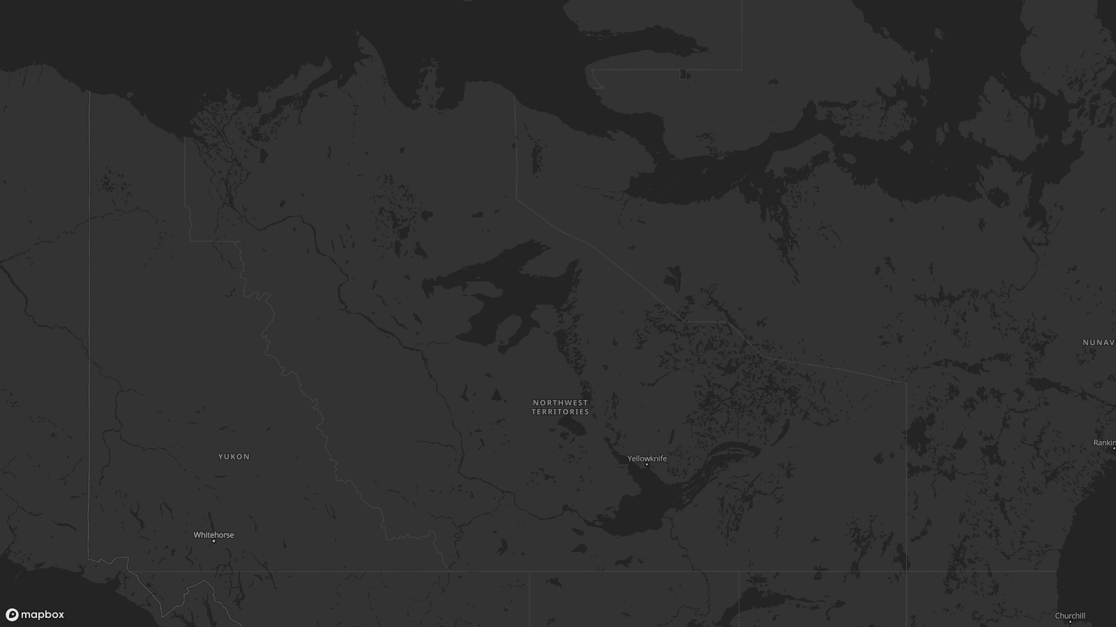
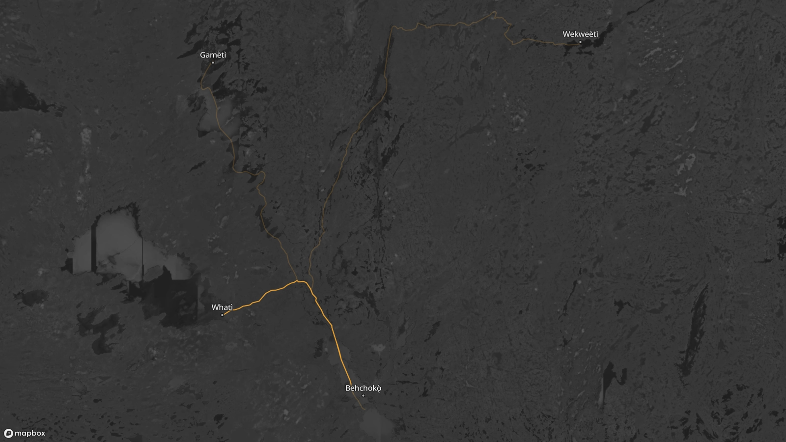
Our lands cover 39,000 square kilometres between Great Bear Lake (Sahtı̀) and Great Slave Lake (Tıdeè).

Map showing the traditional trails linking the Tłı̨chǫ communities of Behchokǫ̀, Whatì, Gamèti, and Wekweėti. Yellow trails are marked to indicate roads used in the winter when the lakes and rivers freeze over. Blue trails are marked to indicate trails that follow the natural path of rivers between communities. Green trails are marked to indicate the paths that dog sled teams travel from Behchokǫ̀ to Wekweėti.Map showing the traditional trails linking the Tłı̨chǫ communities of Behchokǫ̀, Whatì, Gamèti, and Wekweėti. Yellow trails are marked to indicate roads used in the winter when the lakes and rivers freeze over. Blue trails are marked to indicate trails that follow the natural path of rivers between communities. Green trails are marked to indicate the paths that dog sled teams travel from Behchokǫ̀ to Wekweėti.

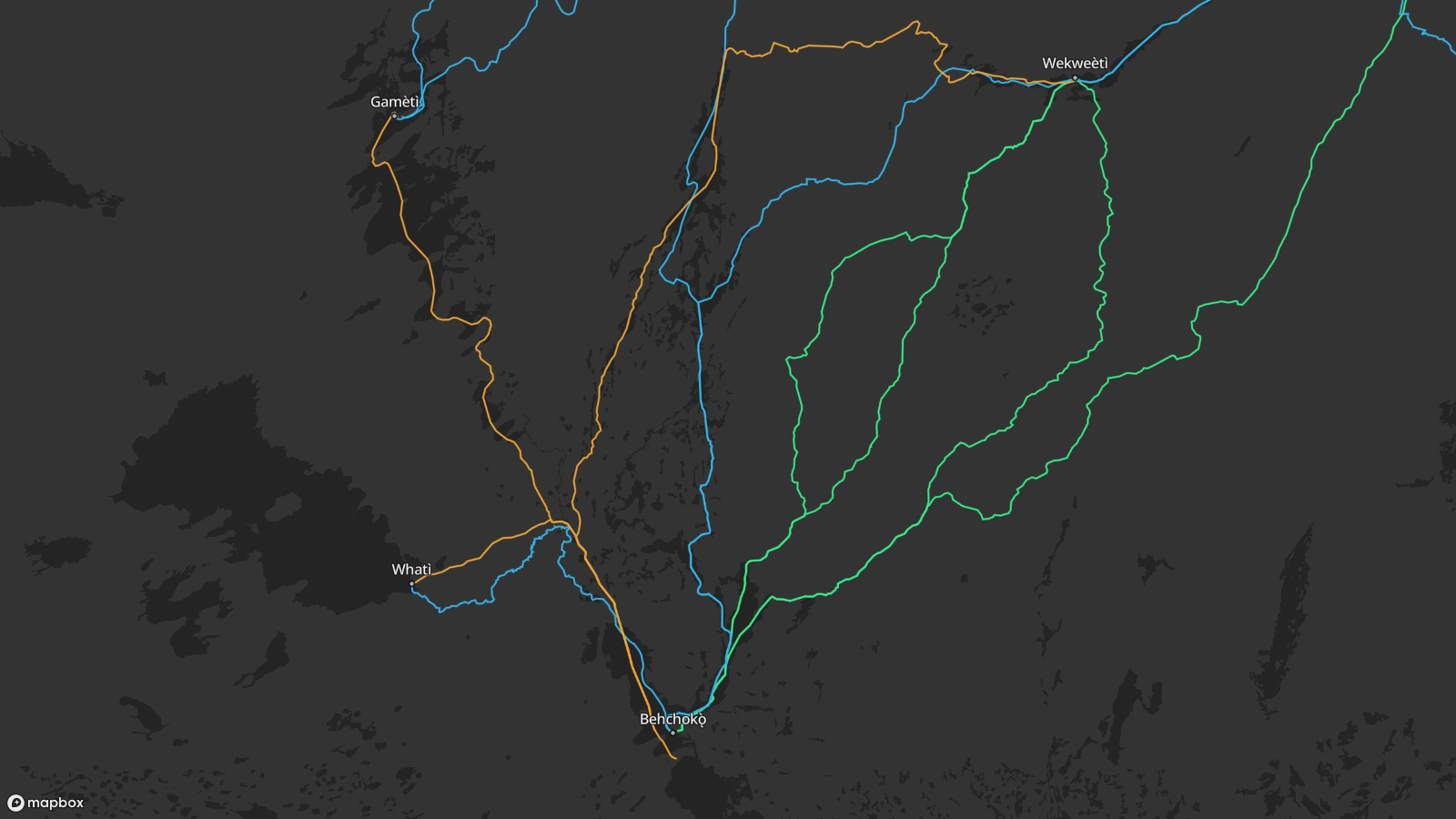
Our people reside mostly in the four communities of Behchokǫ̀, Whatì, Gamèti, and Wekweètì.

For centuries we have lived an annual cycle that follows wildlife through a network of traditional hunting trails. These trails now connect the four communities.

A map showing the Whatì trail linking Behchokǫ̀ and Whatì in the Northwest Territories, traveling north from Behchokǫ̀ through Marian Lake, up the Marian River, before branching west up the Lac La Martre river, and finally ending up in Lac La Martre.A map showing the Whatì trail linking Behchokǫ̀ and Whatì in the Northwest Territories, traveling north from Behchokǫ̀ through Marian Lake, up the Marian River, before branching west up the Lac La Martre river, and finally ending up in Lac La Martre.

Today we travel these trails to teach our youth the skills needed to live in harmony with the land and connect them to a culture that has been strong for thousands of years.

Explore the trails and discover the stories that make us Tłı̨chǫ.